


研究室紹介
Exploration Geophysics
Department of Earth Resources Engineering, Faculty of Engineering
Department of Earth Resources Engineering, Graduate School of Engineering
Department of Earth Resources Engineering, School of Engineering
In the field of medicine, physical techniques such as ultrasound and X-rays are widely used to visualize the interior of the human body and detect abnormalities and lesions. Similarly, “geophysical exploration” refers to the technology used to visualize (or image) subsurface conditions that cannot be directly observed with the human eye, by employing various physical phenomena such as seismic waves, electromagnetic fields, magnetism, and gravity. Data acquired by various sensors on the ground, in the air, or at sea are used to image the underground, and the resulting images are interpreted by integrating relevant scientific and technical knowledge to understand subsurface conditions.
Geophysical exploration has long developed as a key technology for investigating underground resources such as petroleum, natural gas, geothermal energy, and mineral deposits. Today, its applications have expanded to a wide range of fields, including the construction and maintenance of infrastructure such as tunnels and river embankments, underground utilization such as CO₂ geological storage, environmental conservation through imaging of groundwater distribution, and disaster prevention through the detection of faults and volcanic activity. In recent years, technological advances have made it possible not only to image underground structures but also to monitor dynamic changes, such as fluid migration and crustal deformation.
At our Exploration Geophysics Laboratory, we are actively engaged in research and development of geophysical exploration technologies to address various social challenges related to the subsurface, aiming to contribute to the realization of a sustainable society.
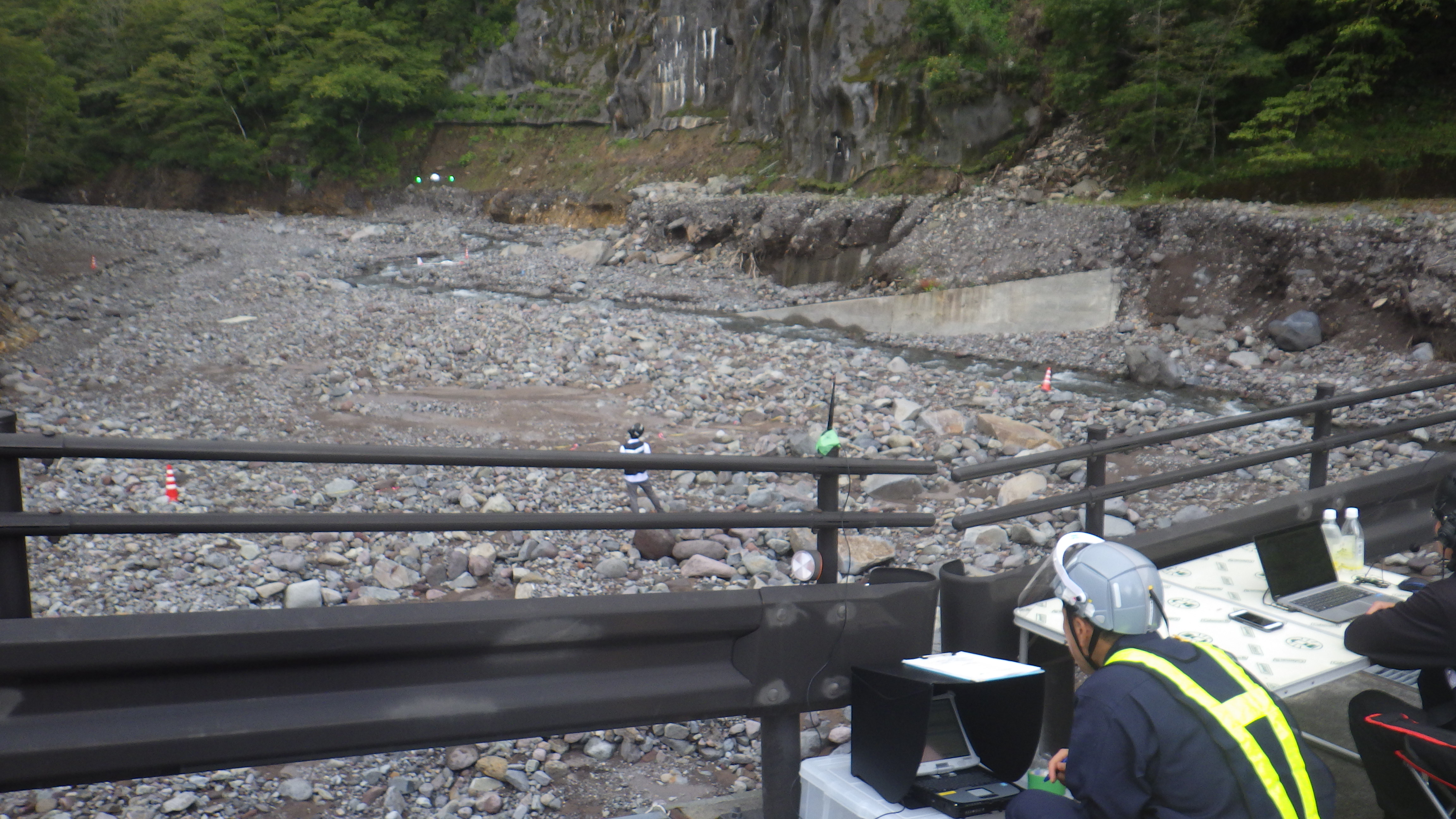
Field experiment of a drone-borne electromagnetic survey system.
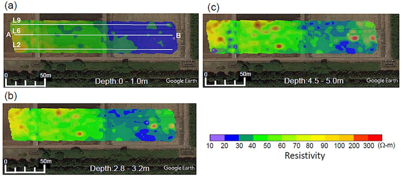
Resistivity distribution imaged by the drone-borne electromagnetic survey method.
Staff
Prof. Yuji Mitsuhata
Assoc.Prof. Tatsunori Ikeda
Asst.Prof. Toshiaki Tanaka
The Main Research Topics
- Development of distributed acoustic sensing (DAS) technology using optical fibers for CO₂ geological storage monitoring
- Development of compact MT (Magnetotelluric) measurement equipment for efficient geothermal resource exploration
- Development of 3D electrical resistivity data analysis techniques considering mountainous terrain for landslide disaster prediction
- Study on the application of seismic exploration on the Moon